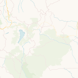
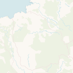
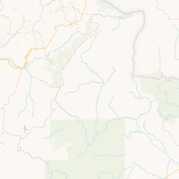
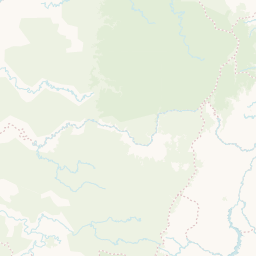
cartodb_id_ | the_geom_GEO | area_acto__ | cedula_cat_ | codigo_pue_ | codigo_ter_ | fecha_acto_ | id_resguar_ | matricula__ | nombre_res_ | numero_act_ | numero_pla_ | objectid_ | obs_plano_ | obs_res_ | observacio_ | pueblo_ | shape_are_ | shape_len_ | the_geom_webmercator_GEO | tipo_acto__ | |
|---|---|---|---|---|---|---|---|---|---|---|---|---|---|---|---|---|---|---|---|---|---|
3 | GeoJSON | 4782.5 | null | 1005 | null | 710985600000 | null | null | RAMOS-MONGON-MANCHURIA | 29 | P-198843 | 61 | P1:P-198843 - P2: - P3: - P4: - P5: | R1: - R2:29-33798 - R3: - R4: - R5: - R6: - R7: | null | AWÁ | 0.003410869060808 | 0.402645433489917 | GeoJSON | RESOLUCIÓN | |
5 | GeoJSON | 4482.30175781 | null | 1005 | null | 1014768000000 | null | null | CHAGUI CHIMBUZA VEGAS Y OTROS | 3 | I-630.383 | 102 | P1:I-630.383 - P2: - P3: - P4: - P5: | R1: - R2:3-37314 - R3: - R4: - R5: - R6: - R7: | null | AWÁ | 0.002815505587556 | 0.572452909042055 | GeoJSON | RESOLUCIÓN | |
10 | GeoJSON | 2775 | null | 1005 | null | 734745600000 | null | null | CUCHILLA-PALMAR | 82 | P-466292 | 171 | P1:P-466292 - P2: - P3: - P4: - P5: | R1: - R2:82-34073 - R3: - R4: - R5: - R6: - R7: | null | AWÁ | 0.002087321407352 | 0.265258955714281 | GeoJSON | RESOLUCIÓN | |
11 | GeoJSON | 7314 | null | 1005 | null | 734745600000 | null | null | PALMAR IMBI | 082 | 630246 | 176 | P1: - P2: - P3: - P4: - P5: | R1: - R2: - R3: - R4: - R5: - R6: - R7: | null | AWÁ | 0.005940516103145 | 0.771795724158898 | GeoJSON | RESOLUCIÓN | |
65 | GeoJSON | 6.9183 | 000300050023000 | null | LEGALIZACIÓN DECRETO 1071 | 1512950400000 | null | 240-164837 | LAGUNA PEJENDINO | 42 | ACCTI 5200143 | 733 | null | null | GLOBO 10 - NOMBRE PREDIO: EL ARRAYAN | QUILLASINGA | 1.0372204e-8 | 0.000475585925053 | GeoJSON | ACUERDO | |
66 | GeoJSON | 6.9183 | 000200110794000 | null | LEGALIZACIÓN DECRETO 1071 | 1512950400000 | null | 240-129760 | LAGUNA PEJENDINO | 42 | ACCTI 5200143 | 734 | null | null | GLOBO 8 - NOMBRE PREDIO: ALTAMIRA 1 | QUILLASINGA | 3.8110237e-8 | 0.000830269428282 | GeoJSON | ACUERDO | |
67 | GeoJSON | 6.9183 | 000200120703000 | null | LEGALIZACIÓN DECRETO 1071 | 1512950400000 | null | 240-151025 | LAGUNA PEJENDINO | 42 | ACCTI 5200143 | 735 | null | null | GLOBO 2 - NOMBRE PREDIO: DELICIAS | QUILLASINGA | 1.87122552e-7 | 0.002619135605299 | GeoJSON | ACUERDO | |
68 | GeoJSON | 6.9183 | 000200120858000 | null | LEGALIZACIÓN DECRETO 1071 | 1512950400000 | null | 240-223315 | LAGUNA PEJENDINO | 42 | ACCTI 5200143 | 736 | null | null | GLOBO 1 - NOMBRE PREDIO: EL VERGEL LOTE 7 | QUILLASINGA | 0.000002213092728 | 0.006755184246945 | GeoJSON | ACUERDO | |
69 | GeoJSON | 6.9183 | 000100530120000 | null | LEGALIZACIÓN DECRETO 1071 | 1512950400000 | null | 240-59381 | LAGUNA PEJENDINO | 42 | ACCTI 5200143 | 737 | null | null | GLOBO 14 - NOMBRE PREDIO: EL PORVENIR | QUILLASINGA | 3.91479418e-7 | 0.002801749813479 | GeoJSON | ACUERDO | |
70 | GeoJSON | 6.9183 | 000100380070000 | null | LEGALIZACIÓN DECRETO 1071 | 1512950400000 | null | 240-204501 | LAGUNA PEJENDINO | 42 | ACCTI 5200143 | 738 | null | null | GLOBO 19 - NOMBRE PREDIO: ESPERANZA | QUILLASINGA | 6.37705448e-7 | 0.003337795475579 | GeoJSON | ACUERDO | |
14 | GeoJSON | 9070.27734375 | null | 1018 | null | 1126742400000 | null | null | SIMORNA | 29 | 10-0-00019 | 226 | P1:10-0-00019 - P2: - P3: - P4: - P5: | R1: - R2:29-38610 - R3: - R4: - R5: - R6: - R7: | null | EMBERA CHAMI | 0.010867067794276 | 0.90948534117044 | GeoJSON | RESOLUCIÓN | |
45 | GeoJSON | 10501.25 | null | 1005 | null | 993686400000 | null | null | TRONQUERIA, PULGANDE-PALICITO | 13 | B-637.480 | 495 | P1:B-637.480 - P2: - P3: - P4: - P5: | R1: - R2:13-37070 - R3: - R4: - R5: - R6: - R7: | null | AWÁ | 0.010014813230775 | 0.731188111410605 | GeoJSON | RESOLUCIÓN | |
25 | GeoJSON | 3252 | null | null | null | 1450656000000 | null | null | KAMÉNTSÁ BIYA DE SIBUNDOY | 4 | 017629AE86749 | 299 | P1: - P2: - P3: - P4: - P5: | R1: - R2: - R3: - R4: - R5: - R6: - R7: | null | KAMENTSA | 0.034641924452217 | 1.51228807663277 | GeoJSON | RESOLUCIÓN | |
30 | GeoJSON | 7334.2109 | null | 1005 | null | 1450656000000 | null | null | AWÁ ÑAMBL PIEDRA VERDE | 7 | 014501AE52079 | 336 | P1: - P2: - P3: - P4: - P5: | R1: - R2: - R3: - R4: - R5: - R6: - R7: | null | AWÁ | 0.00595832821152 | 0.642641220273463 | GeoJSON | ACUERDO | |
31 | GeoJSON | 9731.77636718 | null | 1018 | null | 1126742400000 | null | null | ALTO ORITO | 19 | 10-0-00020 | 338 | P1:10-0-00020 - P2: - P3: - P4: - P5: | R1: - R2:19-38610 - R3: - R4: - R5: - R6: - R7: | null | EMBERA CHAMI | 0.009968859854986 | 0.644043416468336 | GeoJSON | RESOLUCIÓN | |
40 | GeoJSON | 7801.40380859 | null | 1005 | null | 1049932800000 | null | null | SAUNDE GUIGUAY | 28 | I-630.440 | 406 | P1:I-630.440 - P2: - P3: - P4: - P5: | R1: - R2:28-37721 - R3: - R4: - R5: - R6: - R7: | null | AWÁ | 0.006099690479672 | 0.803212855883354 | GeoJSON | RESOLUCIÓN | |
41 | GeoJSON | 3037.20507812 | null | 1005 | null | 1171497600000 | null | null | PLANADAS TELEMBÍ | 97 | null | 411 | P1: - P2: - P3: - P4: - P5: | R1: - R2:97-39128 - R3: - R4: - R5: - R6: - R7: | null | AWÁ | 0.002533471612665 | 0.335944594675621 | GeoJSON | ACUERDO | |
43 | GeoJSON | 8825 | null | 1005 | null | 881712000000 | null | null | EL SANDE | 43 | R-584.266 | 439 | P1:R-584.266 - P2: - P3: - P4: - P5: | R1: - R2:43-35774 - R3: - R4: - R5: - R6: - R7: | null | AWÁ | 0.007098236522843 | 0.48851604664621 | GeoJSON | RESOLUCIÓN | |
80 | GeoJSON | 6.9183 | 000200110795000 | null | LEGALIZACIÓN DECRETO 1071 | 1512950400000 | null | 240-129768 | LAGUNA PEJENDINO | 42 | ACCTI 5200143 | 748 | null | null | GLOBO 8 - NOMBRE PREDIO: ALTAMIRA | QUILLASINGA | 2.6130806e-8 | 0.000793774022817 | GeoJSON | ACUERDO | |
1 | GeoJSON | 152.12739562 | null | null | null | 970531200000 | null | null | SAN JUAN DE PAMPON | 38 | B-615.838 | 38 | P1:B-615.838 - P2: - P3: - P4: - P5: | R1: - R2:38-36595 - R3: - R4: - R5: - R6: - R7: | null | EPERARA SIAPIDARA TRUA | 0.000033877488363 | 0.031529370805443 | GeoJSON | RESOLUCIÓN |


